Pasterze Glacier at Grossglockner: Viewpoints and What to Expect
See the Pasterze Glacier from Kaiser-Franz-Josefs-Höhe on the Grossglockner High Alpine Road, with views of Austria's tallest mountain and a shrinking glacier.
On this page
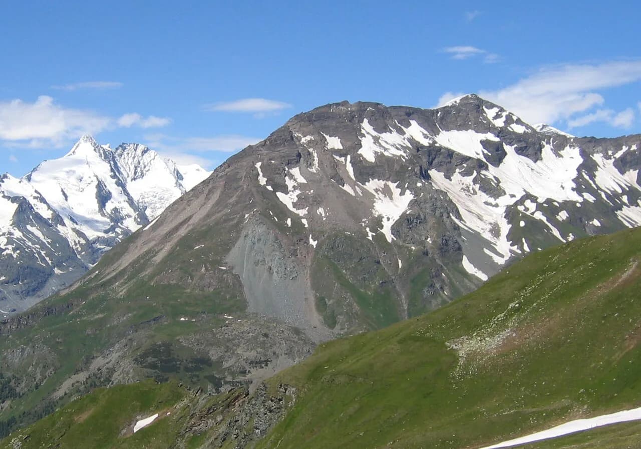
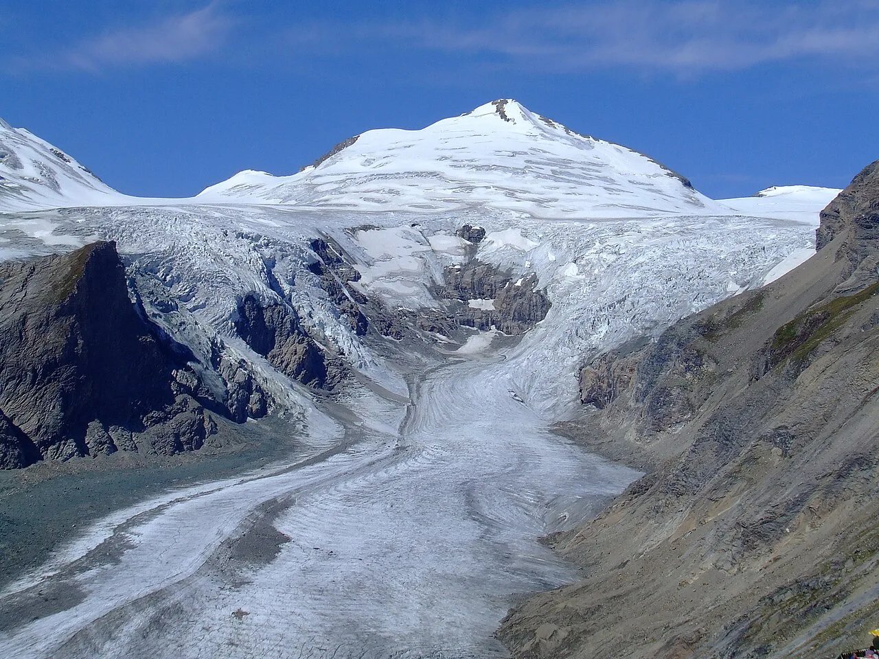
The Pasterze Glacier is the longest glacier in the Austrian Alps, roughly 8 kilometers (5 miles) of ice in the Hohe Tauern National Park, and the standard place to see it is the Kaiser-Franz-Josefs-Höhe viewpoint on the Grossglockner High Alpine Road. From there the ice spreads below Austria's tallest mountain, the Grossglockner at 3,798 m (12,460 ft), so one stop gives you the glacier and the peak in a single frame.
This guide covers what the glacier is, why Kaiser-Franz-Josefs-Höhe became the viewing point, the retreat figures documented for the ice, and the practical side of the trip: road season, tolls, altitude conditions and where the Pasterze slots into a Grossglockner route. It treats the view as a baseline you can date rather than a permanent postcard.
What the Pasterze Glacier is and where it sits
The Pasterze runs down from the Grossglockner massif in the eastern Alps, inside the Hohe Tauern National Park, and it is the largest glacier in the eastern Alps. The ice sits at high altitude, with the Grossglockner's pyramid rising directly above it and the road approaching from Heiligenblut to the south.
Its setting is the reason it matters to travelers: the glacier is the central feature of the Hohe Tauern high country, and the road that crosses it links Heiligenblut am Großglockner in the south with the Salzburg side in the north.
Why Kaiser-Franz-Josefs-Höhe is the place to see it
Kaiser-Franz-Josefs-Höhe takes its name from Kaiser Franz-Josef's visit in 1856, and the visitor center there stands directly before the Grossglockner. That position gives a wide view over the Pasterze, the longest glacier in the eastern Alps, without any walking on ice.
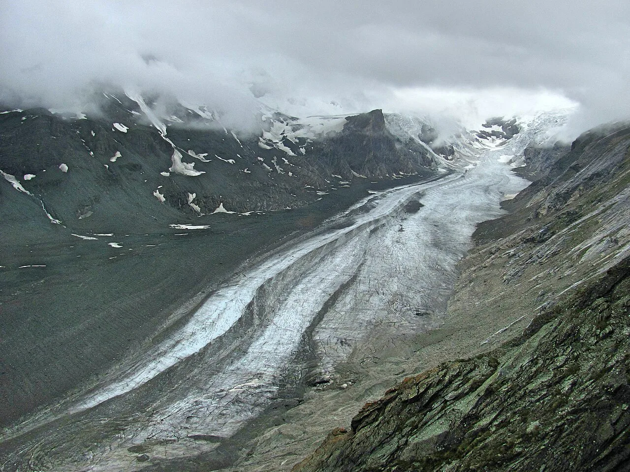
The viewpoint works because the glacier fills the valley below and the Grossglockner fills the skyline above it, so you see the source and the ice in one look. Come here expecting a terrace view, not a glacier walk: the ice is below the road, and the reward is the scale and the documented retreat rather than close contact.
The view from the visitor center
Plan your viewing like a mountain stop rather than a museum visit: the glacier and the peak are the main event, and the year markings explain what changed. Confirm current opening with the Grossglockner road operator before you rely on any indoor facilities at the visitor center.
Plan your viewing like a mountain stop rather than a museum visit: the glacier and the peak are the main event, and the year markings explain what changed. The visitor center also runs indoor exhibits and a funicular down toward the ice, so check with the Grossglockner road operator for current opening before you rely on them.
How fast the Pasterze is retreating
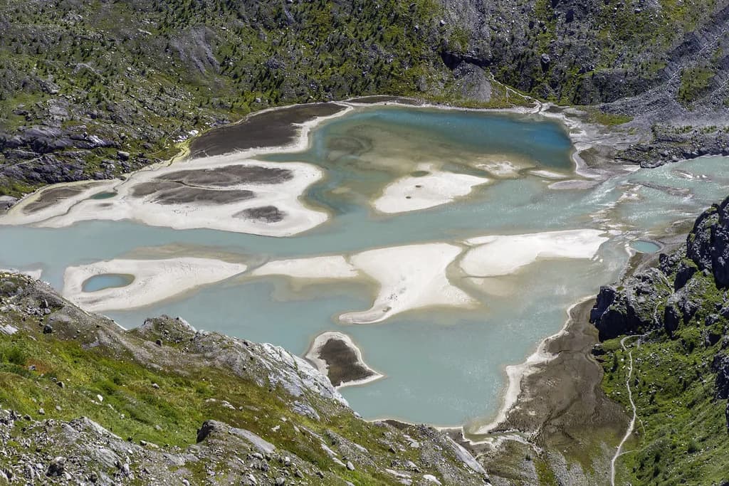
The Pasterze has been receding since 1856, driven by higher summer temperatures and lower winter snowfall. Its thickness falls by more than 5 m each year, its length shrinks by about 10 m (33 ft) a year, and its volume has halved since the first measurements in 1851.
Over the longer record, the glacier has shrunk by roughly a third since the end of the Little Ice Age. Read the viewpoint with those rates in mind: the ice you see is a snapshot, and the year boards are the honest measure of how far the edge has moved rather than a promise that the glacier looks the same as in older photographs.
Planning around the Grossglockner High Alpine Road's open season
The Pasterze viewpoint is reached by the Grossglockner High Alpine Road, a toll road that runs only in the warmer half of the year, and the high pass sections can be affected by snow outside midsummer. Treat the road's open season and daily status as the first thing you check, then build the glacier stop into that window.
At this altitude the weather changes quickly, so carry warm layers and wind protection even on a mild valley morning. The Grossglockner road operator publishes the toll, current season dates and any closures; check them on the operator's site before you drive up.
What to expect on the ground at the viewpoint
Kaiser-Franz-Josefs-Höhe sits at road level with parking and the visitor center beside the viewpoint, so the glacier is a short walk from the car rather than a hike. Allow a focused stop for the terrace view and the year boards, plus extra time if you add the exhibits or a meal once you have confirmed they are open.
The cold at this height is the real constraint on how long you linger, and cloud can swallow the Grossglockner without warning. Build flexibility into the day: if the peak is hidden, the marked glacier positions still make the stop worthwhile, and you can wait for a break in the cloud.
Tolls, altitude and the trade-offs of the drive
Driving up means paying the Grossglockner road toll and accepting a mountain road with steep gradients and hairpins, plus cold, changeable conditions at the top. The trade-off is straightforward: the drive buys you the closest road access to the Pasterze and the Grossglockner's north face, and the price of that access is the toll and the weather risk.
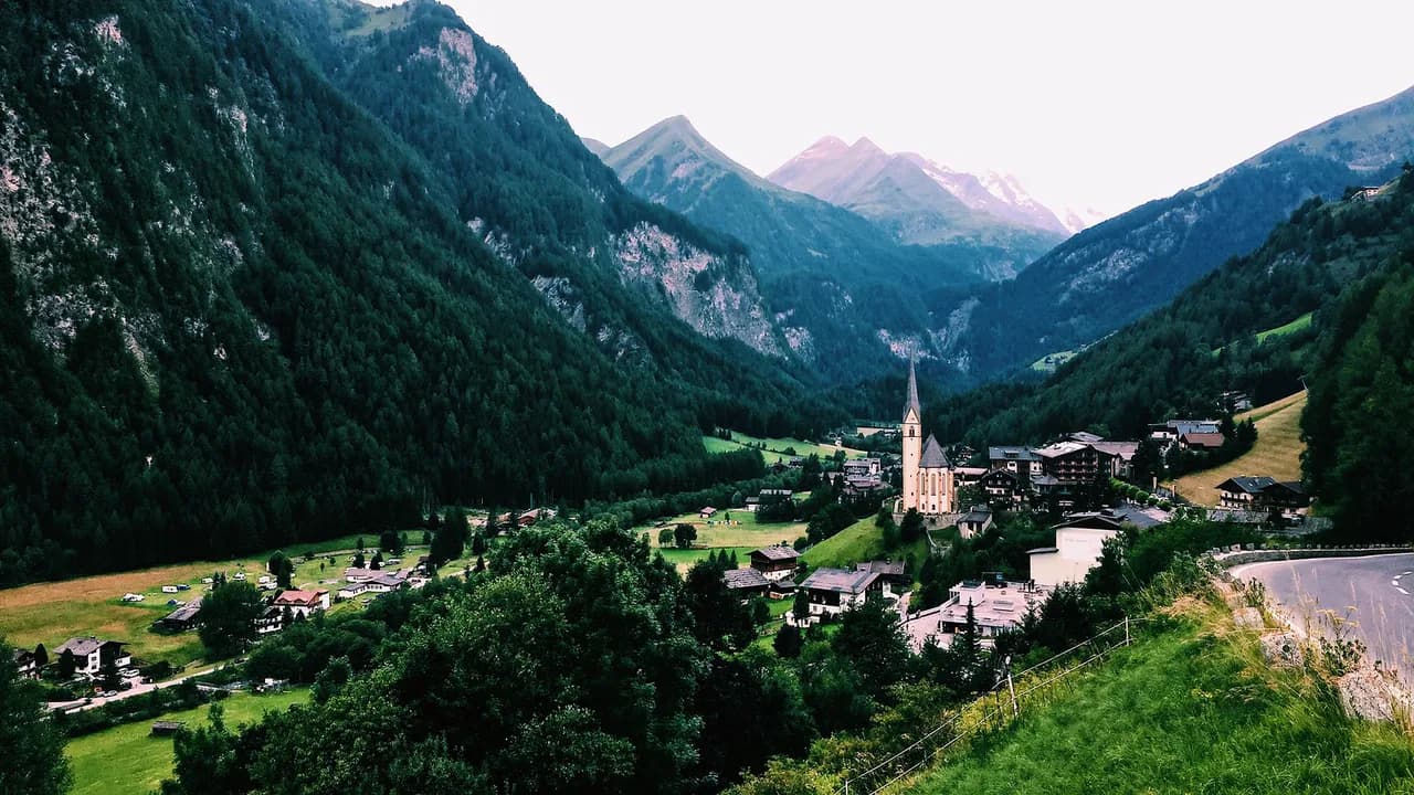
If you are heading south afterward, the road drops toward Heiligenblut am Großglockner, whose pilgrim church and village center make a natural stop before you continue into Carinthia. From the Tyrol side, gateways such as Kals am Grossglockner and Matrei in Osttirol put you within reach of the massif's other flanks.
The classic approach is to cross the Grossglockner High Alpine Road from north to south, with Kaiser-Franz-Josefs-Höhe as the midpoint stop for the Pasterze and the Grossglockner view, then continue down to Heiligenblut. Allow a full day for the crossing with the glacier stop, since the road itself is slow and the altitude rewards unhurried time.
Where the Pasterze fits in a Grossglockner route by car
If you are based in Carinthia or East Tyrol, approach from Heiligenblut or Matrei in Osttirol for a shorter run to the viewpoint. From the Salzburg side, the road climbs from the northern valleys toward the glacier, so plan the day around a single crossing rather than a there-and-back detour.
If you are based in Carinthia or East Tyrol, approach from Heiligenblut or Matrei in Osttirol for a shorter run to the viewpoint. From the Salzburg side, Bruck an der Glocknerstraße is the usual starting point before the toll station, and from there the road climbs past Edelweissspitze toward the glacier.
For a different high-alpine day, the Nockalm Road offers a gentler scenic drive in the same region, and the Hohe Tauern National Park's Mittersill base and Krimml Waterfalls suit a slower national-park itinerary. Whichever route you choose, keep the Grossglockner road's opening status as the deciding factor and treat the Pasterze as the highlight of a day built around the drive.
Should the Pasterze be your Grossglockner stop?
Yes, if you are already driving the Grossglockner High Alpine Road: Kaiser-Franz-Josefs-Höhe gives you Austria's longest glacier and the country's tallest peak in one view, with year boards that make the retreat visible. It is a viewpoint, not a glacier walk, so book it as a scenic high point of a road day rather than a separate expedition.
If the road is closed or the weather is poor, switch to a lower alpine drive or a national-park stop and save the Pasterze for a clear day. Check the road's season, toll and daily status with the operator before you commit the day.
Explore more Heiligenblut guides
Frequently Asked Questions
Can you walk on the Pasterze Glacier?
The Pasterze is seen from Kaiser-Franz-Josefs-Höhe, where the glacier lies below the visitor center and road; the viewpoint is a terrace with views and year boards rather than a route onto the ice. Whether any guided access toward the glacier is running depends on the operator's current program, so check with the Grossglockner road operator before you plan around it.
How long is the Pasterze Glacier today?
The Pasterze is described as the longest glacier in the Austrian Alps at roughly 8 kilometers, and it has been shrinking since 1856 at about 10 m (33 ft) of length a year. Because the ice retreats steadily, treat any figure as a dated measurement and look for the current length from the glacier's scientific monitoring rather than a fixed number.
Sources
Notes for your next Austrian town break
Optional updates when we add or revise town guides.
You might also like
Continue reading
More guides you'll find useful