Malta High Alpine Road: Austria's Kölnbrein Dam Drive in Carinthia
The Malta High Alpine Road climbs 14.4 km through rock tunnels and past waterfalls to the Kölnbrein Dam. Here is what the drive involves and how to plan it.
On this page
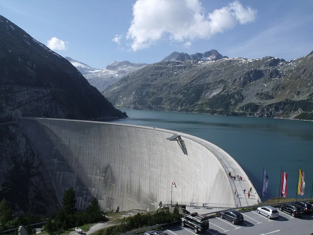
The Malta High Alpine Road is a 14.4-kilometer mountain road in Carinthia's Maltatal valley that ends at the Kölnbrein Dam, Austria's tallest at 200 meters high and 626 meters wide, sitting at 1,902 meters. It is a destination in its own right rather than a shortcut, and it is often confused with the Grossglockner High Alpine Road far to the west. This guide covers the drive itself, what waits at the top, the 2026 season and hours, how to approach from the A10, and where the Malta road stops being the right choice.
What the Malta High Alpine Road is and where it starts
The road, signposted as the Malta Hochalmstraße, leaves the Malta valley floor and climbs to the Kölnbrein Reservoir inside the Hohe Tauern National Park. VERBUND, the hydropower company that built and runs the dam, operates the road and the visitor facilities at the top, so the whole route is a single ticketed excursion rather than a public through-road. You buy access at the valley end and drive up; there is no alternative route over the mountains here. The operator posts weather closures on its site, and the road can be shut on a given morning regardless of the published season.
The climb covers 14.4 kilometers of Alpine road, marked by rock tunnels and hairpin bends, with thundering waterfalls close to the roadside on the way up. Treat the drive as part of the sightseeing: the operator describes the journey itself as a small adventure rather than pure transport. Allow extra time for photo stops at the pull-offs, because the road is narrow in places and you will not want to rush the curves.
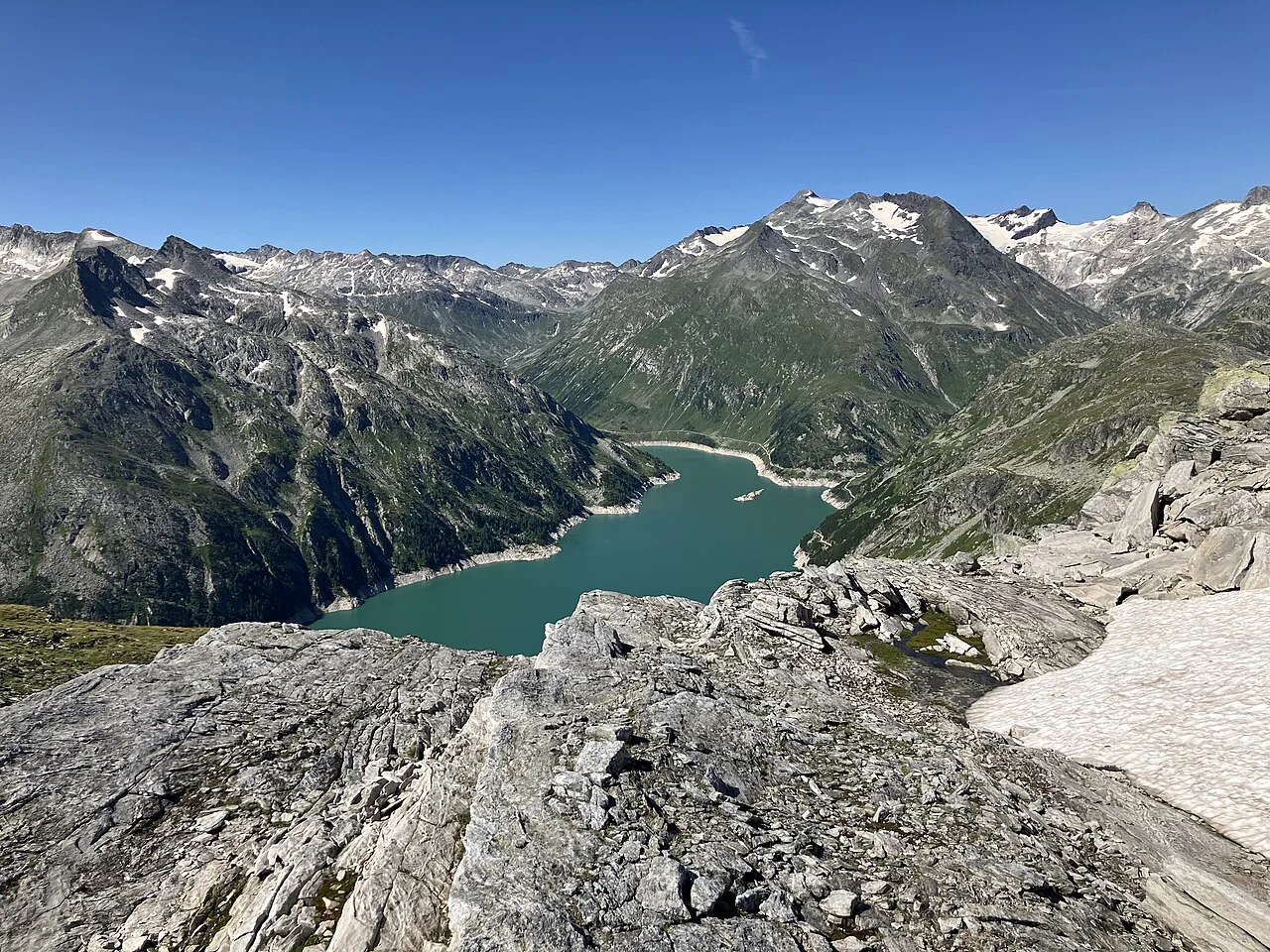
Driving the 14.4 km route: tunnels, hairpins and waterfalls
Expect a steady gradient with tight bends and short unlit tunnels cut straight through the rock, so headlights go on before the first tunnel mouth. The road is a two-lane mountain road with no guardrail on every stretch, and passing places and viewpoints come and go quickly. Drivers who dislike exposure to drops should keep their eyes on the center line and let faster local traffic pass at the wider bends.
The falls beside the road are the visual highlight of the climb, and they run hardest in late spring and early summer when snowmelt feeds the Malta valley. In dry late-summer weeks the flow thins, which changes the drama of the drive but not its shape. If the waterfalls are the reason you came, aim for the earlier part of the season rather than the final October weekends.
At the top: the Kölnbrein Dam, the Airwalk platform and the reservoir
At 1,902 meters the road ends at the Kölnbrein Dam, whose wall holds back the turquoise Kölnbrein Reservoir. The Airwalk viewing platform juts out over the dam wall, giving a straight-down look at the drop and a long view along the water. An information point with a souvenir shop sits beside it, and the dam car park is the starting point for walks around the reservoir and into the surrounding peaks. All of this is reachable only while the operator has the road open for the day.
The scale is the point: a 200-meter-high, 626-meter-wide wall explains why this is Austria's largest dam and why the reservoir reads as a lake pinned between rock walls. Budget time to walk out onto the wall itself rather than only photographing it from the platform. Wind at this altitude is common even on warm valley days, so a layer you can pull on at the top earns its space in the car.
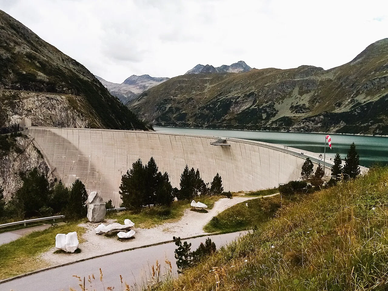
The VERBUND Energy World Malta exhibition and guided dam tours
The VERBUND Energy World Malta exhibition explains how the dam was built and how the hydropower scheme works, which gives context to the water you have been driving beside. Guided tours of the dam take visitors inside the structure, and the Kärnten Card listing notes a 15 percent discount on that tour for cardholders. Tours run on a set schedule rather than continuously, so plan the drive around a tour slot if going inside matters to you.
The exhibition and information point are indoors, which makes them the sensible fallback when cloud swallows the reservoir view. Check the tour times and current ticket prices at the information point on arrival or on the operator's booking page before you commit to a slot, and confirm the road is open before you drive up.
Season and hours: daily 7:00 a.m. to 6:00 p.m., May 8 to October 26, 2026
The operator publishes a daily 7:00 a.m. to 6:00 p.m. season running from May 8 to October 26, 2026, and treats those dates as weather-dependent rather than guaranteed. The start of the season can be pushed back by snow or avalanche risk, and the operator specifically flags May and October as months to check conditions before setting out. The road can also be closed on individual days during the season; a closure notice on the operator's site overrides the published dates on any given morning. The same 7 a.m. to 6 p.m. daily pattern from early May to the end of October appears in the Kärnten Card listing for the road.
A closure notice on the operator's site is the definitive word on any given morning, so look at it before you leave the valley. That is the single check that matters most, because a shut road turns a planned half-day at the dam into a wasted drive up the Maltatal.
How long to allow at the dam
The Kärnten Card listing gives a dwell time of roughly 3 to 4 hours at the destination, which covers the exhibition, the dam wall, the Airwalk and a meal. That figure is the listing's estimate for the site, not a door-to-door time for your trip. Add the climb and descent on the road itself on top of it when planning the day.
A tighter visit of about two hours at the top works if you skip the exhibition and the guided tour and go straight to the dam wall and platform. The trade-off is real: the tour is the only way inside the dam, and the exhibition is what makes the engineering legible. Decide which of the two you would regret missing before you set the schedule.
Getting there by car from the A10 exit at Gmünd into the Maltatal
By car, leave the A10 Tauern Autobahn at the Gmünd exit and follow signs toward the Maltatal and the Malta Hochalmstraße. Parking at the Kölnbrein Dam is free, according to the Kärnten Card listing, so the car park at the top is not a cost to weigh. There is no rail station at the dam, and reaching the valley head relies on the road.
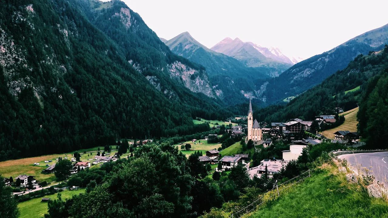
If you are coming from the west, Heiligenblut am Großglockner and the Grossglockner High Alpine Road sit on the other side of the Hohe Tauern, linked to the Maltatal through the mountains rather than by a single direct pass. Treat the two drives as separate days unless you have checked a route and the timing for connecting them.
Parking at the dam and where to eat
At the top, the Berghotel Malta houses the panoramic Hochalm restaurant, with views over the reservoir and the surrounding Hohe Tauern peaks. It is the main sit-down option at the dam, and it doubles as a place to stay overnight inside the national park if you want the morning light on the water. Huts around the dam area serve simpler food for walkers.
Because the restaurant is the only full-service kitchen at this altitude, lunch queues build around midday in high season. Eating earlier or later, or bringing provisions for the drive up, keeps the day moving. The car park being free means the meal is the main optional spend once you are through the toll.
Sights along or near the road: Carinthia's tallest waterfall and the Fallbach
The operator places Carinthia's tallest waterfall directly along the climb, visible from the road as you pass, so keep an eye out on the way up. The falls are part of the drive rather than a separate detour, which is what makes the Malta valley a satisfying outing beyond the dam itself.
If you want more waterfalls and national-park scenery in the same region, the Krimml Waterfalls on the Salzburg side of the Hohe Tauern are the better-known set piece and belong to a different day. The Malta road's falls are the ones you see without leaving the car.
Who the drive suits, and whether the Grossglockner High Alpine Road is the better alternative
The Malta road suits travelers who want a compact, high-reward Alpine drive with a specific engineering sight at the end: the dam, the platform, the exhibition, the restaurant. It does not suit anyone looking for a long scenic traverse or a route that connects two regions, because it dead-ends at the reservoir and you drive back down the way you came. The absence of a through-route is the honest limitation.
The Grossglockner High Alpine Road is the alternative when you want the classic long high-alpine crossing, with the Pasterze Glacier and the Edelweissspitze among its stops, running between Bruck an der Glocknerstraße in Salzburg and Heiligenblut in Carinthia. That is a bigger, longer day with a different purpose, and it is not a substitute for the Malta dam visit. Choose the Grossglockner for the crossing and the Malta road for the dam.
Is the Malta High Alpine Road worth the climb?
Yes, if a short, dramatic drive ending at Austria's tallest dam is the kind of day you want in Carinthia. The combination of tunnels, waterfalls, the 200-meter wall, the Airwalk platform and a guided look inside the dam packs a lot into one road. Plan it for a clear day inside the May 8 to October 26, 2026 season, confirm the road is open before you set out, and give the top three to four hours.
Skip it if you are chasing a long through-drive across the Alps, and take the Grossglockner instead. Pair the Malta day with Heiligenblut am Großglockner on the far side of the Hohe Tauern if your route loops that way, and treat the two as separate outings with separate weather windows.
Explore more Heiligenblut guides
Frequently Asked Questions
Do I need to book the Malta High Alpine Road in advance?
The operator sells admission at the road and online, and guided dam tours run on set times. If going inside the dam is the point of your visit, look at tour slots when you buy admission so the drive and the tour line up, and check that the road is open for the day before you drive up.
Can I drive the Malta High Alpine Road in a motorhome or with a trailer?
The route is a narrow mountain road with tight hairpins and rock tunnels, so a large vehicle or trailer makes the climb harder rather than easier. Ask the operator at the toll point about vehicle limits before you start up.
What should I do if the road is closed for weather?
The operator posts a closure notice on its site, and the season start can slip because of snow or avalanche risk. Treat a closed road as a reason to stay lower in the Maltatal valley rather than driving up for nothing, and try again on a clearer day.
Sources
Notes for your next Austrian town break
Optional updates when we add or revise town guides.
You might also like
Continue reading
More guides you'll find useful