
Hallstätter See: Visiting the Lake at Hallstatt
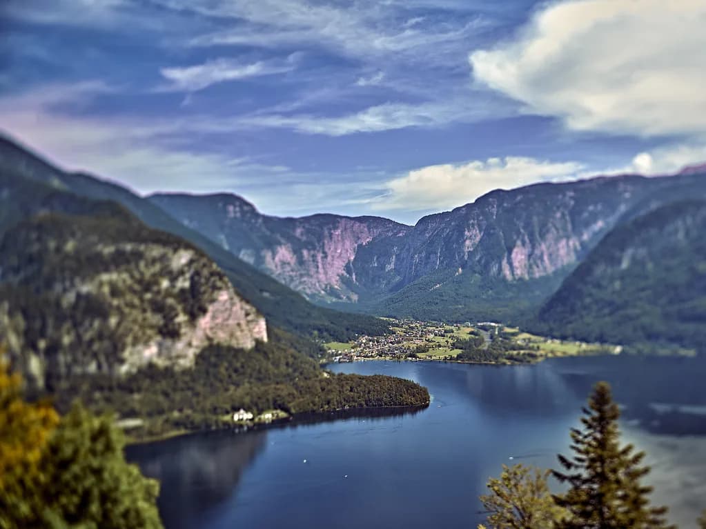
Hallstätter See is the reason Hallstatt photographs the way it does: a narrow, fjord-like lake pressed between steep mountain flanks in the Salzkammergut, with the village stacked on a small fan of land at its western edge. Allow half a day for the waterfront and the village core, or a full day if you want the lake from a boat and a mountainside above it. For the village sights around the water, see Hallstatt Attractions: 11 Visitor Guides.
Treat the lake as a place in its own right rather than scenery behind the village. Hallstatt occupies the western shore, while Obertraun sits at the southern end and Bad Goisern a.H. spreads along the northern stretch of the same water, so the shoreline you choose changes the crowd level and the view.
What and where the Hallstätter See is
The Hallstätter See lies in the Salzkammergut in Upper Austria, cut into the mountains of the Dachstein area, and sits at roughly 508 meters above sea level. Its flanks drop steeply to the water, which is why the far shore has no through road and why the lake reads as a fjord rather than a broad swimming lake. The Dachstein massif and its foothills frame the water on the southern and western sides.
Hallstatt itself was built on a fan of sediment that the Waldbach stream deposited over millennia, raising the ground as much as 17 meters above lake level before the village core took shape on top of it. That explains the village's tight, stepped layout: the streams and the slope, not a planned grid, fixed where the lanes and houses went. The Salzbergbahn up to the Hallstatt Skywalk climbs from the same narrow strip.

The lake by the numbers
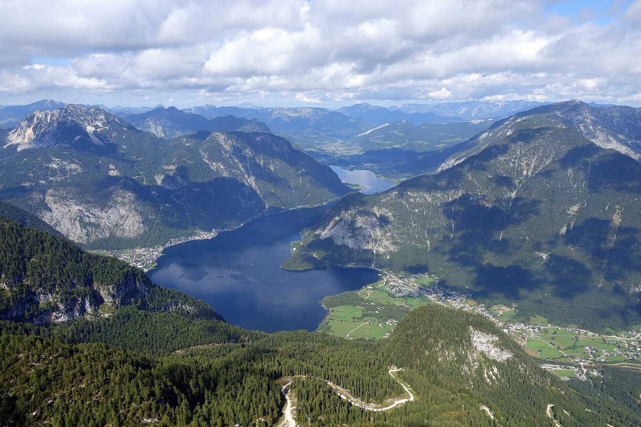
The lake runs about 7.5 kilometers from end to end and covers 8.55 square kilometers, with a maximum depth of around 125 meters. Four inflows feed it: the Traun, the Gosaubach, the Waldbach and the Zlambach. The Traun is also the lake's only outflow, so the water has one exit at the northern end.
Those dimensions matter for planning: the lake is long and thin, and the mountains above the shore rise to the Sarstein on the east, the Plassen slopes to the west, and the Krippenstein and Hirlatz above Obertraun in the south. You cannot walk the whole shoreline quickly, and the opposite bank is mountain rather than promenade.

The villages on the shore
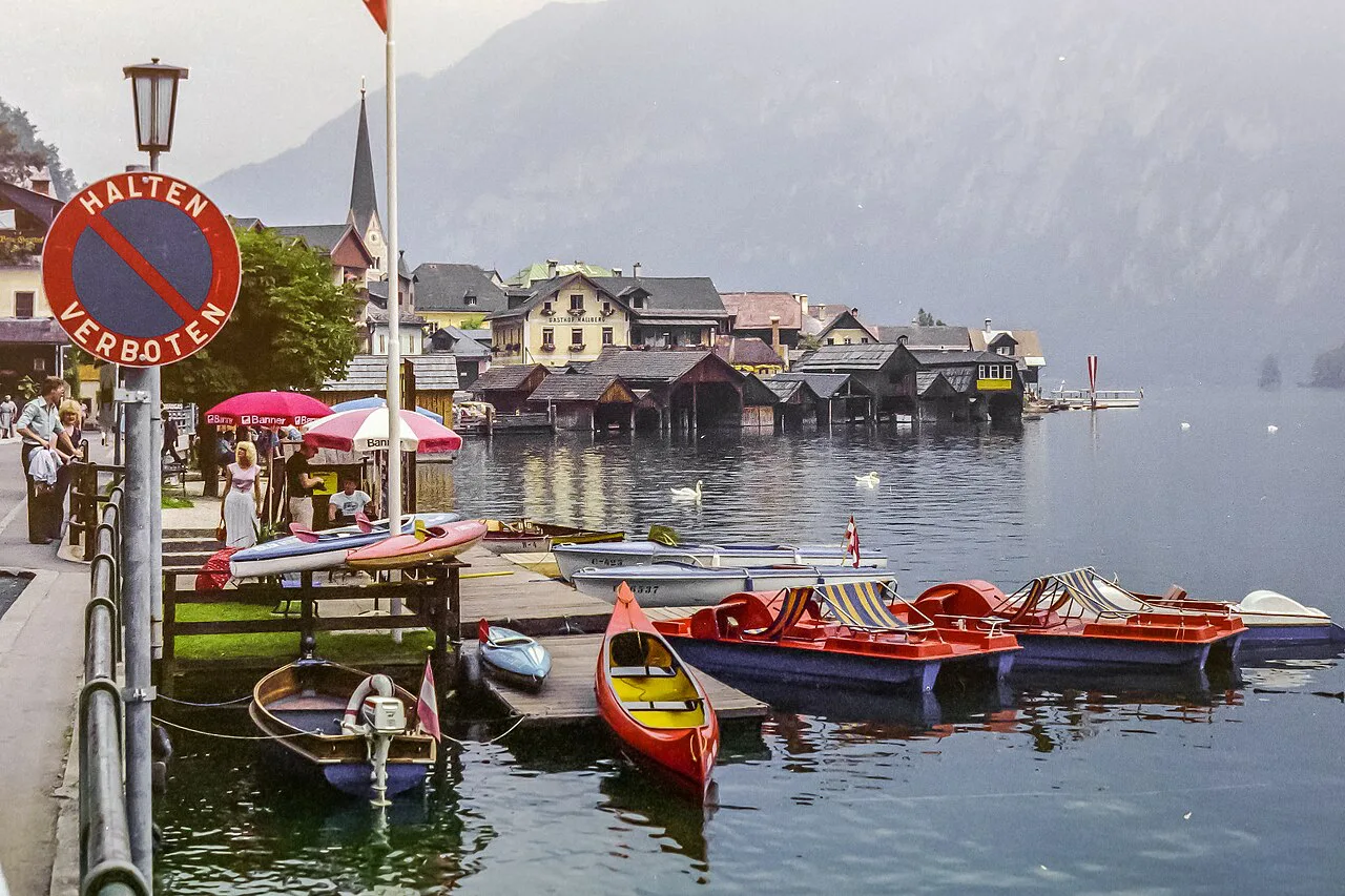
Hallstatt occupies the western shore and holds nearly all the iconic views, along with the crowds. Obertraun sits at the southern end, closer to the Dachstein caves and with a flatter, more open shoreline. Bad Goisern a.H. spreads along the northern stretch of the lake and the valley beyond.
If you want the lake without standing shoulder to shoulder at the classic viewpoint, base yourself at the quieter end and visit Hallstatt early or late. The water is the same; the difference is how much of the shoreline you have to yourself.
Getting to the lake by train and boat
Hallstatt's train station sits across the lake from the village, so the railway arrival is only half the journey; the Hallstatt ferry page covers that connection. The connecting boat across the water is the standard finish to the trip and the first proper view of the village from lake level. Check the current sailing and connection times against the train timetable before you commit to a late arrival.
The regional boat operator, Hallstättersee Schifffahrt, runs the crossings and lake trips; the tourist office links to it as the water-borne option for the area. Confirm the day's schedule and fares with the operator, since they change with the season.
By car, and what the shore feels like without one
Driving in is possible, but Hallstatt's village lanes are effectively pedestrian, and the parking areas for Hallstatt, Gosau and Obertraun are the practical places to leave the car. From there you walk or take the boat. The tourist offices for the four villages publish arrival and parking guidance for each.
Once you are out of the car, the lake's character changes: the eastern bank is a steep, wooded wall with no road, and the western bank is the village street. The best approach is to pick one shore, walk it, and use the boat to cross rather than trying to circle the lake by road.
The classic waterfront and the Waldbach cascades
The postcard view comes from the northern edge of the village, where the houses step down to the water and the steep flanks close in behind. The Waldbach drops through the center of Hallstatt in a series of cascades before reaching the lake, and the lanes cross it on small bridges; the Hallstatt Waterfall guide covers the stream. Walk the waterfront early if you want the frame without a crowd in it.
The village core around the Marktplatz is compact enough to cover on foot in an hour or so, with the Catholic Church and the Lutheran Church both within a short climb of the water.
Seeing the lake from the water
The boat is not just transport: the crossing gives you the village and the mountain wall in one sweep, and the lake trips run from the same operation. The themed Salzschiff, named for the salt trade that built Hallstatt, is one of the boats used on the lake. Book or check times at the landing, and expect the schedule to thin outside the summer months.
If you only have time for one thing beyond the village, make it the water: the perspective from the lake explains why the village was built where it was, on a narrow shelf with the mountain at its back and the deep water in front.
Swimming and the bathing island
Hallstatt has a small bathing island on the lake, and there are four EU bathing spots around the shoreline, with the water reaching summer temperatures near the banks. The tourist office lists the swimming options at Hallstatt, Obertraun and Bad Goisern, including the Strandbad Obertraun and the Strandbad Untersee at Bad Goisern.
The lake is deep and cold away from the shallows, so most people swim near the designated spots rather than off the village quay. Bring what you need; the facilities at the bathing areas are seasonal.
The mountains around the shore
The Sarstein rises on the eastern bank, the Plassen slopes on the western side, and the Krippenstein and Hirlatz stand above Obertraun to the south. These are the walls that make the lake feel enclosed, and they are also why the far shore is wild rather than developed.
Above Hallstatt, the Salzbergbahn carries you up to the Hallstatt Skywalk for the classic view down onto the lake and the village roofs. It opens seasonally, so check the current operating calendar before you plan around it.
How long to allow
A half day covers the waterfront, the Marktplatz and a short climb to one of the churches, with time left for coffee by the water. A full day adds a boat crossing and either the Skywalk or the salt mine above the village. Three hours in Hallstatt is enough for the village, not for the lake.
If you are coming by train, budget the ferry crossing at both ends of the day, since the station is across the water. The return boat is the constraint that shapes an afternoon.
Nearby: salt mine, caves and Gosausee
The Hallstatt Salt Mine sits above the village and is reached by the Salzbergbahn, making it a natural pairing with the lake view. The Dachstein caves above Obertraun offer a very different underground day, and the Gosausee lies beyond Gosau. Each of these is a separate outing, and each has its own seasonal opening pattern to confirm.
Within the village, the Hallstatt Museum (Welterbe Museum Hallstatt) and the Hallstatt Ossuary in St. Michael's Chapel fill a wet hour or two and give context to the salt trade and the village's long history.
Crowds and timing
The waterfront fills at midday, when tour groups arrive and the narrow lanes between the Marktplatz and the lake become slow going. Early morning and late afternoon are calmer, and the light on the water is better for photographs at both ends of the day.
If you want the lake without the crush, spend the middle of the day at Obertraun or on the water rather than in the village center, then return to Hallstatt when the day-trippers have gone. The lake shore spreads the pressure in a way the village lanes cannot.
Is the lake worth more than a photo stop?
Yes, if you give it time: the lake is the reason the village exists, and a boat crossing plus a walk along the water turns a snapshot into an understanding of the place. Half a day is the minimum, a full day is better.
Plan around the boat schedule and the seasonal opening of the Salzbergbahn and the salt mine, and confirm current times and prices with the operator or the tourist office before you go.
Explore more Hallstatt guides
Frequently Asked Questions
Why is Hallstatt so popular?
Hallstatt combines a dramatic lakeside setting, a compact historic center and a long salt-mining history that goes back to the Iron Age. The view from the water and from above the village is what draws most visitors, and the village's small size makes it easy to see in a few hours. The lake itself, the Hallstätter See, is the reason the village sits where it does.
Which movie was filmed in Hallstatt?
Hallstatt has appeared in films and television over the years, but the village is better known for its scenery than for a single film location. If a particular production is your reason for visiting, check with the local tourist office for reliable information rather than relying on online lists.
What are the mountains around Hallstatt?
The Sarstein rises on the eastern bank of the lake, the Plassen slopes on the western side, and the Krippenstein and Hirlatz stand above Obertraun to the south. Above the village, the Salzbergbahn climbs toward the Hallstatt Skywalk viewpoint. These peaks are what give the lake its fjord-like, enclosed character.