
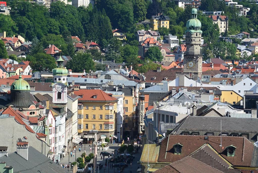
Maria-Theresien-Straße: Innsbruck's Grand Street and Its Landmarks
Walk Maria-Theresien-Straße from south to north and you get Innsbruck in a single stretch: a broad pedestrian boulevard of baroque facades and bay windows, the Annasäule column mid-street, the Triumphpforte arch closing the southern end, and the Nordkette ridge rising straight ahead. It is the city's grandest shopping street and, at the same time, its most photographed piece of townscape. This guide covers what stands where along the street, how to reach it on foot or by tram, how long to allow, and which nearby sights slot into the same walk.
Where the street sits and how it connects to the Altstadt
Maria-Theresien-Straße runs south from the edge of Innsbruck's Altstadt (old town) toward the Triumphpforte, so it works as the natural approach to the historic center rather than a detour from it. The northern stretch is pedestrianized and lined with shops, cafes and outdoor seating, which makes it the busy seam between modern shopping and the old lanes.
The street takes its name from Empress Maria Theresia and has been a showpiece address since the eighteenth century; the whole ensemble has stood under heritage protection since 2006, following a redesign completed between 2009 and 2011 that restored the northern section as a pedestrian zone. Treat those dates as history, not as a schedule of works — the street today is fully open and walkable.

Getting there: on foot, by tram, from the Hauptbahnhof
Most visitors arrive on foot: from the Goldenes Dachl and the Herzog-Friedrich-Straße lanes of the Altstadt, the street begins a couple of minutes south, and the walk from the Triumphpforte to the old town takes well under ten minutes at an easy pace. Trams and buses run along the Marktgraben and Anichstraße corridor beside the street, with stops within a short walk of the Annasäule.
From Innsbruck Hauptbahnhof the street is a straightforward walk of roughly ten to fifteen minutes straight down Museumstraße and Marktgraben; trams in the direction of the city center cover the same distance in a few stops. Confirm current tram lines and departure times on the ÖBB and Innsbrucker Verkehrsbetriebe timetables before you set out, since routes are adjusted seasonally.

The Annasäule: the column in the middle of the street
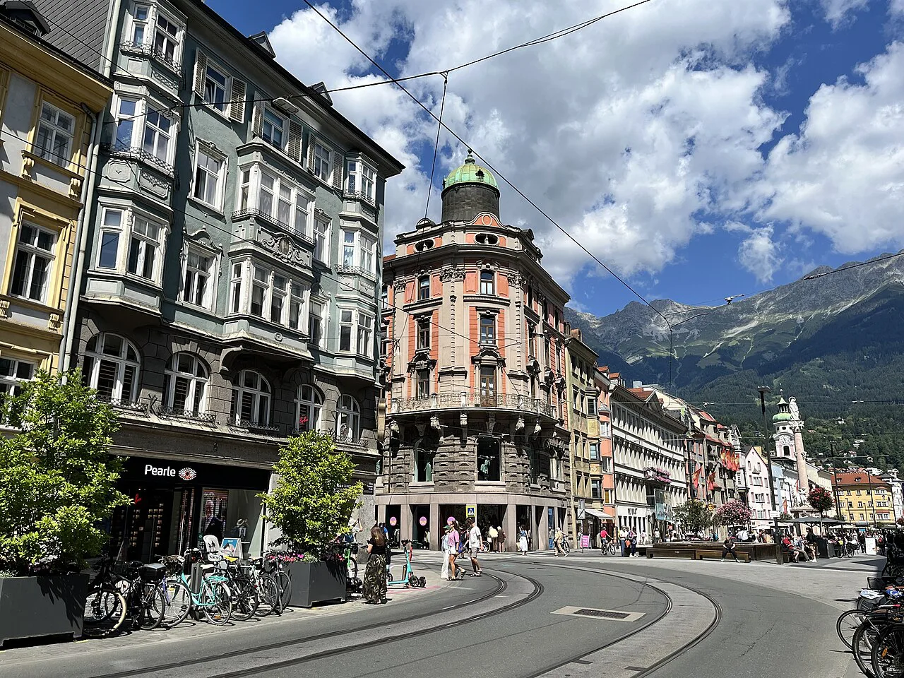
The Annasäule is the fixed point of the street — a Marian column standing in the roadway itself, officially dedicated as a Mariensäule and popularly called after Saint Anne. It divides traffic flow and pedestrian movement, so you will pass it rather than walk around it, and its position is the easiest place to orient yourself: old town to the north, Triumphpforte to the south.
The Triumphpforte at the south end
The Triumphpforte is a marble triumphal arch at the southern end of the street, built in the eighteenth century to mark a Habsburg wedding and now doubling as the street's ceremonial gateway. It sits at the junction where the broad boulevard meets the older street pattern, and it is the natural starting point if you want to walk the street in its intended direction, with the mountains ahead rather than behind you.
The Spitalskirche and the facades along the way
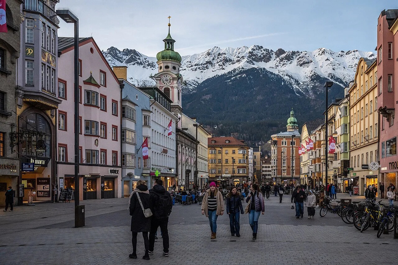
The Spitalskirche, a baroque church with a distinctive facade, stands on the western side of the street, its tower and painted front fitting into the run of patrician houses. The architecture above eye level is the real reward here: ornate Erker (bay windows), stucco facades in warm yellows and ochres, and rococo detailing on buildings now occupied by shops at street level.
The Nordkette view: where to stand
The classic photograph is taken from the southern, Triumphpforte end of the street, looking north up the boulevard toward the Nordkette in the Karwendel range — the mountains rise to the north, so this is the direction that frames the ridge against the baroque facades. On clear days the Serles peak closes the view in the opposite direction, giving the street its unusual framed-by-mountains quality.
If the mountain backdrop is the reason you came, the Nordkettenbahn cable car leaves from the Hungerburg above the city and puts you on the ridge itself; check its seasonal operating calendar and ticket prices at the station or on the operator's site before committing a morning to it.
How long the street is and how long to allow
The pedestrian stretch is only a few hundred yards long, so walking it end to end takes ten minutes at most; allow thirty to forty-five minutes if you want to look at the facades, stop for a coffee and take the mountain view in properly. It fits naturally into a half-day circuit of the Altstadt rather than filling a morning on its own.
Shopping and practical notes
This is a working shopping street first and a sight second: fashion chains, banks, pharmacies and department stores occupy the ground floors, with the Kaufhaus Tyrol among the larger addresses. The street layout is simple — one wide pedestrianized northern section, then the roadway around the Annasäule and south to the Triumphpforte — and there is no entry fee or ticket of any kind, because it is a public street.
Nearby: the Goldenes Dachl, Hofburg and Hofkirche
The Golden Roof (Goldenes Dachl) is a two- or three-minute walk north through the old town lanes, its gilded balcony overlooking the square that has become Innsbruck's signature image. The Hofburg Innsbruck and the Hofkirche with the Maximilian tomb sit at the northern edge of the Altstadt, close enough to combine with the street in a single loop.
For a longer excursion, Ambras Castle Innsbruck sits above the city to the southeast and needs its own half-day; the street is not en route, so plan it as a separate outing rather than a stop on this walk.
What the street is like across the seasons
In summer the cafe terraces fill the northern stretch and the mountain view is at its clearest in the morning light. The street's character shifts with the seasons, but the buildings, column and arch remain the constants, so the walk is worthwhile year-round.
Who should walk it and who can skip it
Walk it if you want the single best free view of Innsbruck's baroque townscape framed by the Nordkette, or if you are crossing between the old town and the station anyway. Skip lingering here if shopping malls and chain stores are not your interest — the architecture is best seen in fifteen minutes on the move, and the old town lanes reward more of your time.
Walk it north to south for the mountain view
The most efficient plan is to start at the Triumphpforte with the Nordkette ahead of you, stop at the Annasäule, note the Spitalskirche facade, and finish in the Altstadt at the Goldenes Dachl — a compact forty-minute route that gives you the street and its landmarks in one line.
Because the street is public and free, the only real costs are your time and whatever you spend in the cafes; use it as the spine of an old-town morning rather than a destination in its own right.
Explore more Innsbruck guides
Frequently Asked Questions
Is Maria-Theresien-Straße free to visit?
Yes. It is a public pedestrian street and shopping boulevard, not a ticketed attraction, so there is no admission charge and no booking needed. You only pay if you shop or stop at a cafe.
How do you reach Maria-Theresien-Straße from Innsbruck Hauptbahnhof?
Walk straight down Museumstraße and Marktgraben; the street begins at the edge of the old town, about ten to fifteen minutes on foot. Trams toward the city center cover the same stretch in a few stops, so check current lines and departure times on the local operator's timetable.
What is the most famous building near the street?
The Golden Roof (Goldenes Dachl) in the old town, a few minutes' walk north, is Innsbruck's best-known landmark. On the street itself, the Annasäule column and the Triumphpforte arch are the two fixed points worth seeking out.