Schlögen Danube Loop: The Schlögener Schlinge Viewpoint Guide
The Schlögen Danube loop cuts a near 180-degree hairpin in Upper Austria. Here is how to reach the Schlögener Blick viewpoint by trail or forest road.
On this page
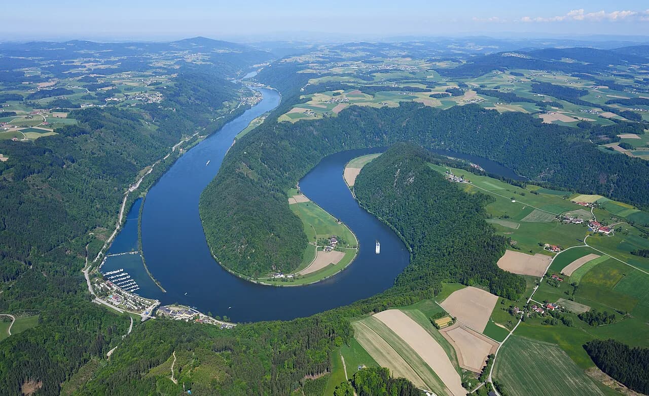
The Schlögen Danube loop, known in German as the Schlögener Schlinge, is the bend where the Danube swings almost 180 degrees through a wooded gorge in Upper Austria, between Schlögen and Haibach ob der Donau. The classic view is the Schlögener Blick, a viewing platform and rest area above the bend that serves as the main viewpoint of the entire Donausteig long-distance trail. This guide covers what the loop is, the two ways up to the viewpoint, parking at Schlögenleiten, access limits and how the stop fits a Danube route.
Plan it as a viewpoint stop of an hour or two around the platform rather than a destination in itself. The platform sits high above the river, so the reward is the geometry of the bend; there is no visitor center or cafe at the top.
What the Schlögen Danube loop is and where it sits
The Schlögener Schlinge lies in the upper Danube valley, where the river is deeply cut into a long breakthrough stretch. Between Schlögen and Haibach ob der Donau the water changes direction almost twice by 180 degrees within a few kilometers, which is what makes the bend read as a natural wonder rather than an ordinary curve.
The bend lies in the Danube region of Upper Austria, whose old towns, abbeys and river stretches anchor a wider trip. Because the loop sits inland from the main Passau–Linz corridor, it works best as a deliberate detour rather than something you glimpse from a train window. For the rest of the province, see our Upper Austria Travel Guide.
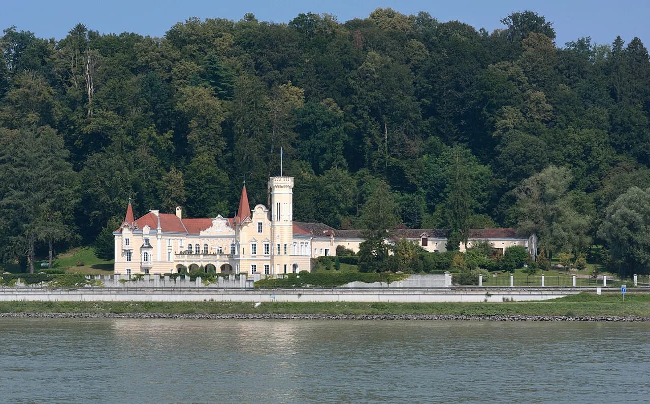
High above the heart of the bend stands the Kerschbaumer Schlössl, a small castle tied to a local Danube legend about a cursed cherry pit. You see it from above rather than visit it, so treat it as scenery that gives the view a landmark.
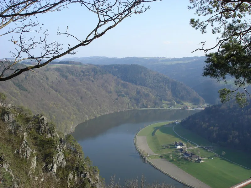
How the river turns: the double bend
The reason the view works is compression: from the platform you look down on water that appears to double back on itself, framed by steep, forested slopes. The Donausteig describes this as the point where the fascination of the natural spectacle becomes fully clear, which is a fair description of why people climb for it.
The Danube here is a working river, and navigation has shaped life in the valley for centuries. That context matters when you look down: the bend is not a wilderness reserve but a gorge that river traffic, farming and forestry have used for a long time.
The bends repeat: past the viewpoint, the gorge valley continues and the river keeps carving through the upper Danube valley. Give the river a few minutes before you turn back so the second turn registers as part of the same pattern.
The Schlögener Blick viewpoint and rest area
The Schlögener Blick is both a viewing platform and a designated Donausteig rest area, set above the bend on the forested slope. You come here for the panorama and a pause, not for exhibits or a guided tour.
The site is listed with free access and is open to the public around the clock, every day of the year, with no entrance fee. Arrive outside the middle of the day if you want the platform and the view to yourself.
There is no indoor shelter or staffed facility at the top, so the view is the whole visit. Take water and a layer for wind, and expect to be back at your starting point well before you need a meal.
Reaching the viewpoint on foot from Schlögen via the Ciconia trail
From Schlögen on the Danube, the climb to the Schlögener Blick runs through steep hillside forest along the Ciconia nature trail, past panels on fungi, ferns, mosses and streams. This is the longer, more physical approach, and it is also the one with interpretive stations along the way.
Once the trail tops out, the path continues through the hillside forest onto the rolling plateau of the Sauwald, a soft landscape of woods, meadows, hedges and scattered farms. That contrast between gorge and plateau is the reason to walk rather than drive.
Guided hikes in the Haibach area are arranged through the local tourist office, which is the right contact if you want a leader on the trail rather than a solo climb.
The shorter forest route from the Schlögenleiten car park
Drivers get a much shorter approach from the car park at Schlögenleiten, from which a forest route leads up to the viewpoint. The tourism office describes it as the leisurely alternative to climbing from Schlögen, so choose it if you want the panorama without a steep forest ascent.
Both approaches end at the same platform, so the view itself does not depend on which one you take. The trade-off is simple: the Schlögen climb gives you the nature trail and the Sauwald plateau, while the Schlögenleiten route gives you a shorter outing.
Parking at Schlögenleiten and what ten spaces mean
The Schlögenleiten car park holds a listed ten parking spaces, which is the practical constraint for anyone driving. On a fine weekend or in high season, treat a place as uncertain rather than guaranteed and have a plan for turning around.
No parking fee or reservation system is published for this car park, so check locally on arrival rather than assuming a machine or an app.
Public transport is an option in principle, and the regional tourism site points travelers toward a route planner for independent trips. Verify connections before you commit, since the last stretch to the trailhead is rural.
The Donausteig stage from Schlögen to Aschach
Travelers who want to keep walking can take the Donausteig stage from Schlögen to Aschach an der Donau, which starts at the bend and crosses the Sauwald before descending into the Eferding basin. The route is listed with a recommended season from March through October.
Along the way the stage passes Haibach, home community of Christoph Zeller, and a short detour to the rural parish church is worth the extra steps. Farther on, the route reaches a hill near Dorf with wide views over the Eferding basin and the Alps on the horizon.
Aschach on the Danube ends the stage as a historic river market town, a fitting place to stop. This is a multi-stage trail, so through-walkers need to sort transport back to their car or onward along the Danube.
Access notes: all-weather site, free access, stairs and slopes
The viewpoint and rest spot are listed as suitable in all weather and across spring, summer and autumn, with winter access depending on snow conditions. In practice that means the platform is a year-round proposition while the paths to it are not always.
The site is not suitable for wheelchairs and is not compliant with Austria's ÖNORM accessibility standard, so travelers with mobility limitations should plan around the climb rather than assume a paved approach.
Because there is no entrance fee and no fixed hours, the main planning variables are daylight and weather rather than a ticket. Build the visit around a dry window and leave before the light goes.
When to go: spring through autumn, winter with care
Spring through autumn is the reliable window, matching the March to October season listed for the Donausteig stage. Summer brings the longest days but also the most traffic at the small car park.
Winter visits depend on snow conditions and suit travelers equipped for cold, slippery ground. The platform stays open, but the forest paths can be the harder part of the trip.
Early arrival also sidesteps the squeeze at the small Schlögenleiten car park, which has only ten spaces. Beyond that, the best hours depend on the day's light and weather.
Where the loop fits in a Danube route
Treat the Schlögener Schlinge as a half-day stop between Passau upstream and Linz downstream, added to a drive or a Donausteig leg rather than replacing one. It pairs naturally with other Upper Austria stops, and a base like Steyr, Austria works for travelers touring the province's towns and river valleys; our Upper Austria overview maps those pieces.
If you are building an itinerary from Linz or Passau, the loop slots in as a scenic break with a short walk attached. For orientation on the rest of the province, the Upper Austria overview covers the towns, abbeys and river stretches that surround it.
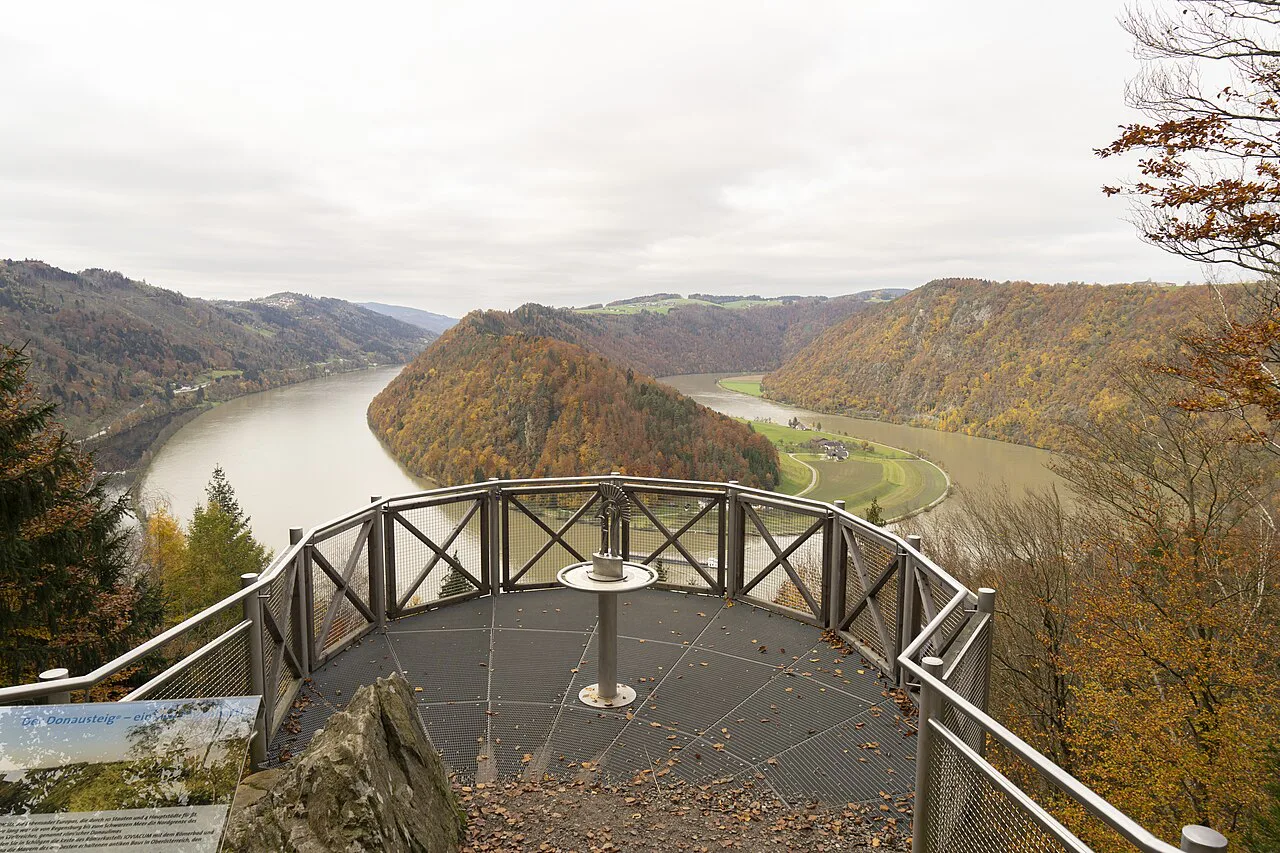
Is the Schlögen Danube loop worth the detour?
Yes, if you are already moving through the upper Danube valley and want one of Austria's clearest river views without a ticket booth or a schedule. The trade-off is infrastructure: ten parking spaces, no facilities at the top and a climb that rules out wheelchair access.
Choose the Ciconia trail from Schlögen if you want the full climb and the Sauwald plateau, or the forest route from Schlögenleiten if you want the view with less effort. Either way, go in the morning, carry water and confirm the day's conditions before you set out.
Explore more Steyr guides
Frequently Asked Questions
Can you drive to the Schlögen Danube loop viewpoint?
You can drive close and walk the rest. The car park at Schlögenleiten has ten spaces, and from there a forest route leads up to the Schlögener Blick. The last stretch to the platform itself is on foot.
Is the Schlögener Schlinge free to visit?
Yes. The viewing point and rest spot are listed with free access, open every day around the clock, with no entrance fee. There is no charge to reach the platform, though any parking arrangement at Schlögenleiten is worth confirming on site.
How long does the walk from Schlögen to the viewpoint take?
The climb from Schlögen follows the Ciconia nature trail through steep hillside forest, so allow more time than for the short forest route from Schlögenleiten. Walk at your own pace, since the ascent is the demanding part of the visit.
Sources
Notes for your next Austrian town break
Optional updates when we add or revise town guides.
You might also like
Continue reading
More guides you'll find useful